About 900 years ago, a boy named Al-Idrisi was born. He grew up in North Africa. As a young man, he loved to travel. He saw many lands.
Globe: roundMapa flat drawing
The king's big job
Later he went to the island of Sicily. Its king, Roger, asked him to make a world map. A map is a drawing of a place from above.
Asking the travelers
Al-Idrisi could not visit every place himself. So he asked many travelers and sailors. What did you see? How far did you go? He wrote down what they said.
Real photo
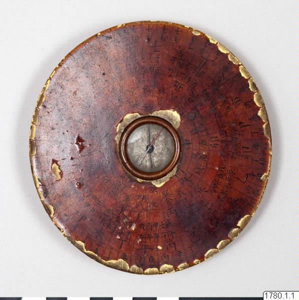
The sailors' compass
Some sailors used a compass. In China, people found a special stone. A needle rubbed on it points north. About 900 years ago, sailors began using compasses at sea. There are no roads on the sea.
Four directions
A compass shows four directions: north, south, east and west. South is the opposite of north. East is the opposite of west. Most maps today put north at the top.
Real photo
South on top
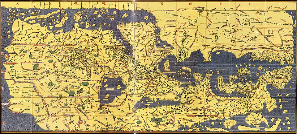
In 1154, Al-Idrisi finished his big map. It had south at the top. Today maps often have a key. A map key tells what the little pictures mean. A globe is a round model of Earth.
For parents
Goal: Your child learns what maps, globes and compasses are, and how Al-Idrisi made his world map by asking travelers.
Ask: why did Al-Idrisi ask so many travelers?
Ask: if north is at the top of the map, where is south?
Look at a map key together and name what each little picture means.
Away from the screen: Draw a simple map of your home or street from above. Add a map key and mark north at the top.
 Real photo
 Real photo